Ouaddaï and Abéché
Eastern region of the Ouaddaï sultanate, where Abéché retains its mud-brick mosques, its sultanic palace and a camel market frequented by Maba and Zaghawa traders.
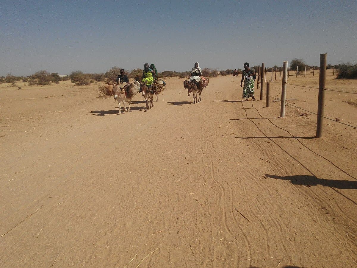
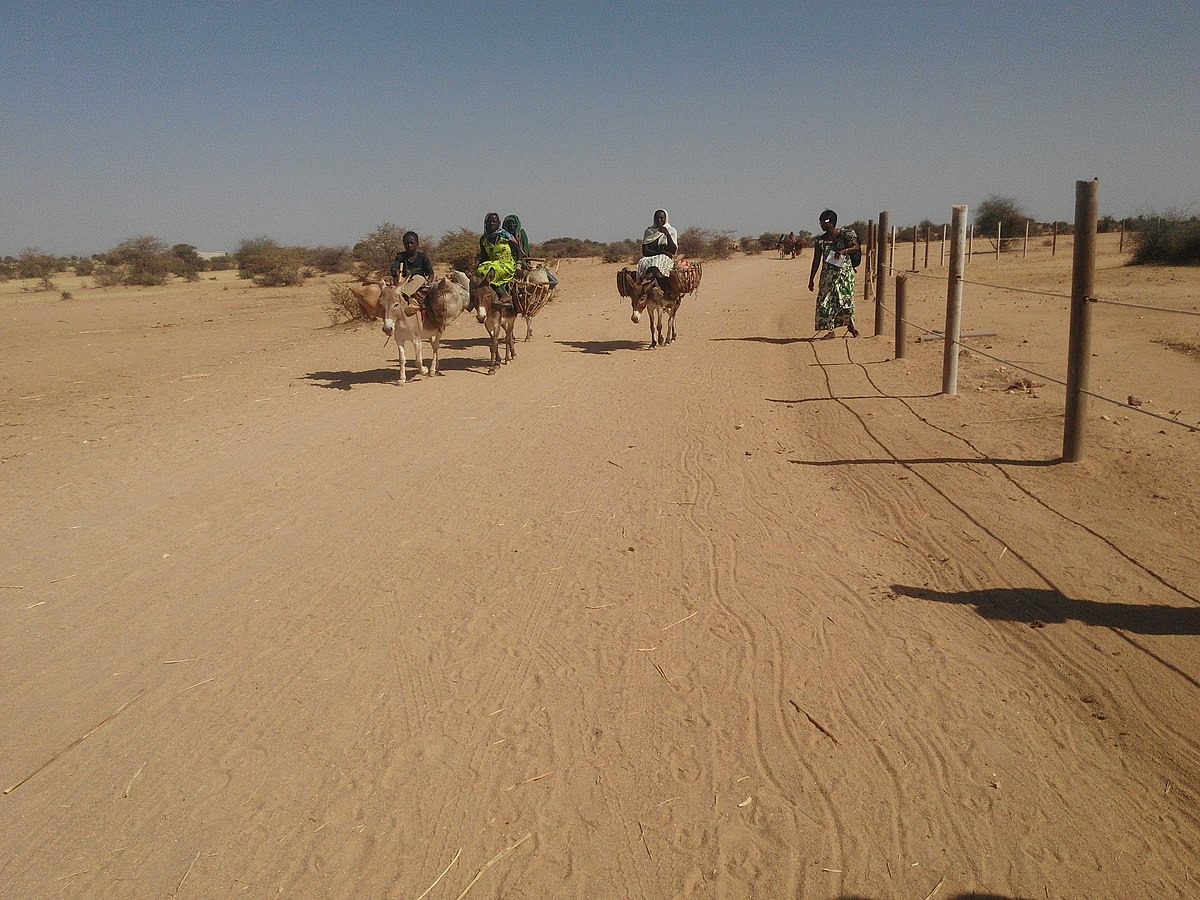
Ouaddaï occupies eastern Chad, between the Guéra massif to the west and the Sudanese border to the east. It is a transition zone between the Sahel and the desert, comprised of stony plains, isolated granite hills known locally as koros, and seasonal riverbeds lined with acacias, jujubes and tamarinds. Average altitude ranges from 500 to 800 metres, which moderates temperatures slightly compared to the Chad basin. The region encompasses the cities of Abéché, Adré on the border, Biltine further north, and numerous villages such as Abougoudam, Am Zoer and Goz Beïda in neighbouring Dar Sila.
Abéché, the former capital of the Ouaddaï sultanate from the 17th century to the early 20th century, retains an urban layout inherited from that era. The grand mud-brick mosque, restored several times over, remains the focal point of the old town centre. The sultan's palace, still occupied by the current sultan who exercises customary authority, testifies to Ouaddaï's political role before French colonisation in 1909. The earthen walls, largely collapsed, are still visible in sections at the town's edges. The sultans' cemetery, a few kilometres away, contains the tombs of successive sovereigns and attracts discreet visits.
The population comprises several groups we present to travellers according to encounters: the Maba, the sultanate's historical founders and the majority around Abéché; the Zaghawa, semi-nomadic herders with ties across the Sudanese border, present mainly towards Biltine and Iriba; the Tama, settled farmers; and the Mahamid or Misseriya Arabs, camel drivers and cattle herders encountered on the northern routes. Chadian Arabic serves as the lingua franca, Islam structures the calendar, and weekly markets remain the primary space for exchange between these communities.
The economy relies on transhumant pastoralism (camels, cattle, small livestock), rain-fed agriculture of pearl millet and sorghum concentrated in valleys, and caravan trade that persists despite the advent of trucks. Abéché's camel market, held mainly during the dry season, sees several hundred animals pass through weekly from Darfur and Batha. Blacksmith-jewellers, traditionally endogamous, work silver filigree for the necklaces and bracelets worn by Maba women at weddings. Weavers still produce some cotton cloth, though Sudanese textile imports have diminished this craft.
Cuisine in Ouaddaï centres on millet balls served with okra sauce or sharmout, a sauce of dried meat. Red tea with cardamom, steeped slowly in small enamelled teapots, punctuates visits. During the rainy season, hibiscus juice and jujube fruit are also consumed. Religious festivals, particularly Eid al-Adha, mark the year and occasion equestrian parades in the sultanic palace courtyard, when circumstances permit.
For the traveller, Ouaddaï is not a spectacular destination in the sense of the great desert landscapes of Ennedi or Tibesti. It is a region of historical and human depth, where interest builds through encounters, markets, earth-built architecture and village traversals. Its position also makes it the logistical pivot eastward and north-eastward across the country, shaping most itineraries we design from N'Djamena.
Highlights
Old town of Abéché and the sultan's palace. Wander through lanes in the ancient centre around the grand mud-brick mosque, to the palace where the sultan of Ouaddaï resides, heir to a 17th-century lineage.
Abéché's camel market. Held on the town's edge during the dry season, it brings together Arab and Zaghawa camel herders from Batha and the Sudanese border to negotiate beasts destined for export.
Villages of Abougoudam and surroundings. Round huts with conical thatched roofs, granaries on stilts and blacksmith workshops working silver with mouth-blown blowtorches, an hour's drive from Abéché.
Cemetery of the Ouaddaï sultans. Burial site away from town, grouping the tombs of successive sovereigns beneath earth domes, visited with a customary guardian.
Road to Adré and acacial-lined riverbeds. Traversal of the Sahelian steppe between granite koros and seasonal river beds, to the border post of Adré facing Sudanese Darfur.
When to visit
The ideal window runs from mid-November to mid-March. It is the cool dry season, with daytime temperatures of 28 to 33°C and nights dropping to 13-16°C in December and January, sometimes lower on the heights around Biltine. The Harmattan, a north-easterly wind bringing sand, reduces visibility some days but renders markets and travel feasible. April and May are to be avoided: heat climbs to 40-42°C in the afternoon, water becomes scarce in villages and daytime visits grow arduous.
From June to mid-October, the rainy season brings 400 to 600 mm cumulative rainfall, concentrated in August. Riverbeds fill suddenly, secondary tracks become impassable for days after each rainfall, and the road link from N'Djamena may be cut. Conversely, the landscape greens and agricultural life resumes, which may interest travellers prepared for uncertain logistics. We advise against this season for combined Ennedi or Tibesti itineraries, whose northern accesses also become difficult.
Practical advice
Allow 2 to 3 days on site to visit Abéché, its immediate surroundings (Abougoudam, sultans' cemetery) and encounter a weekly market. Beyond that, the region gains full meaning if extended to Biltine and Iriba (1 to 2 additional days of rough track) or used as a gateway to Ennedi, adding 2 days of road via Kalaït and Fada. Access is from N'Djamena either by domestic flight (1h30, limited frequency, book early) or by paved road requiring 12 to 14 effective hours, usually split over two days with a stop at Mongo or Abou Deïa.
Comfort remains Sahelian: in Abéché, two or three simple but decent hotels, irregular hot water, air-conditioning on generators. In the bush, we work in tent camps or homestays with village chief agreement. This region suits travellers interested in the history of Sahelian sultanates, earth architecture and pastoral societies, rather than those seeking spectacular landscapes. It combines naturally with Ennedi for a 12 to 15-day itinerary, or with Lake Chad and Kanem to cover the Sahelian arc east to west.