Sahara Desert (Chad) — Ennedi and Tibesti
The Chadian Sahara brings together Ennedi (UNESCO), Tibesti and its volcanoes, and the Borkou oases. Sandstone gorges, rock paintings and desert crocodiles make up a wild and seldom-visited territory.
The Chadian Sahara covers more than half the national territory. It encompasses three major zones: the Tibesti massif in the west, the Ennedi plateau in the east, and the Borkou depression in the centre. This desert is not simply an erg of sand: sculpted sandstone gorges, natural arches, oases and rock paintings make it one of the most varied Saharan landscapes in Africa.
What you will see
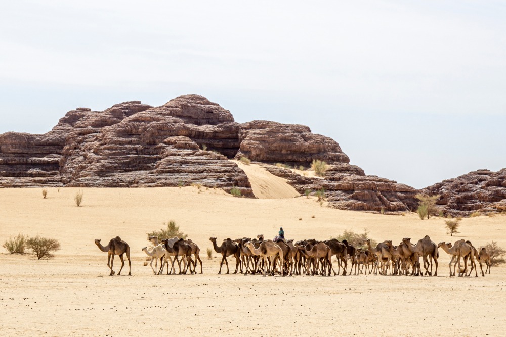
The landscape alternates between ergs (seas of dunes), regs (stony plains) and rocky massifs. Ennedi is home to sandstone formations with spectacular eroded shapes, including the Aloba arch, one of the world's largest natural arches. Tibesti peaks with Emi Koussi, an extinct volcano and the highest point in the Sahara. Oases in the Borkou region, such as Faya-Largeau, offer date palms and permanent water sources.
History and context
The Chadian Sahara was inhabited long before its aridification, roughly 5,000 years ago. Rock paintings and engravings in Ennedi—depicting cattle, giraffes, riders—bear witness to a verdant past. Trans-Saharan caravan routes crossed these lands, linking sub-Saharan Africa to the Mediterranean. The Tibesti massif remains the traditional territory of the Toubou, a nomadic people whose presence is attested for centuries.
Highlights of a visit
Ennedi massif
Listed as a UNESCO World Heritage Site since 2016, Ennedi concentrates steep-sided gorges, gueltas (permanent water holes) and thousands of rock paintings. The Guelta d'Archei is home to a population of desert crocodiles, a relic of prehistoric fauna.
Emi Koussi and Tibesti
This extinct volcano reaches 3,415 m, the highest point in the Sahara and Chad. Access remains difficult and subject to variable security conditions; you must check with your local agency before any plans.
Borkou dunes
Around Faya-Largeau, the ergs offer fine sand dunes. The town is a historic resupply point for caravans and remains the main urban settlement in northern Chad.
Photography tips
The golden light of dawn and dusk reveals the textures of Ennedi sandstone. Avoid midday hours: the white glare washes out relief. For rock paintings, do not use flash—it damages ancient pigments. Always ask permission before photographing residents or Toubou encampments.
Key practical information
- Access: international flight to N'Djamena, then domestic flights or 4×4 track travel depending on destination.
- Best time to visit: November to February (comfortable temperatures, between 15 °C and 30 °C during the day).
- What to wear: covering clothing, maximum sun protection, substantial water supply.
- Safety: consult your government's travel advisories; some areas (Tibesti) are not recommended or off-limits to foreigners without an escort.
- Recommended duration: minimum 7 to 10 days for Ennedi alone; a complete northern circuit requires 2 to 3 weeks.
- Local guides: mandatory to navigate and respect Toubou territories.
Location and access
The Chadian Sahara extends north of the 15th parallel. The main entry point is N'Djamena, Chad's capital. Domestic flights serve Faya-Largeau (Borkou). Ennedi is reached from Abéché (north-east) by 4×4 track, taking several days of travel. No paved roads cross these regions; a four-wheel-drive vehicle with an experienced driver is essential.
Nearby attractions
- Guelta d'Archei — permanent water hole in Ennedi, habitat of the last Saharan desert crocodiles.
- Ennedi massif — UNESCO-listed sandstone plateau, heart of Chad's natural and rock art heritage.
- Faya-Largeau — main northern oasis, gateway to Borkou ergs.
- Lake Chad — to the south-west, a lacustrine ecosystem in transition, crossroads of several nations.
Interested in this visit?
We can include it in your personalised itinerary.
