Tibesti Mountains
Tibesti Mountains
Black volcanoes, lunar craters and remote oases: the Tibesti massif in northern Chad is one of the Sahara's last great expedition destinations.
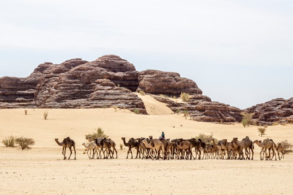
Here lies the ultimate challenge for adventurers on a trip to Chad! The Tibesti mountains, raw and untamed, immerse you in a volcanic realm of jagged horizons. You traverse rocky passes and fields of petrified ash, emerging onto cooled lava expanses and, if fortune smiles, hidden mountain oases. Time to don your expedition hat.
History
Archaeological evidence attests to human presence in Tibesti during the Stone Age. The Toubou, arriving in successive waves from the 5th century B.C. onwards, form the massif's principal indigenous population. Turkish contact came in 1560, a relationship that turned contentious by the late 17th century, culminating in a bloody war in 1780.
At the outbreak of the Italo-Turkish War, the Arab Senussi brotherhood—allies of the Toubou by the turn of the 19th and 20th centuries—joined the Ottoman Empire, which, following a request from the Derdé, the tribal chief, established garrisons in Tibesti in March 1911. Turkish collapse months later benefited the Toubou, who launched a final offensive.
The French army, under Loeffleret's command, entered Tibesti via Kaouar in 1914, forcing the Derdé into exile. A colonial dispute erupted between the Italian Empire established in Fezzan to the north and the French occupying West Africa. During World War I, the Senussi rebelled against the Italians, who temporarily withdrew. In 1916, French forces retreated following resistance led by the Derdé and his followers. However, by 1929, the French colonial empire reclaimed the region, placing it under French Equatorial African administration. Peace came slowly, and the Derdé gradually restored his authority. After Chad's independence in 1960, the administrative and judicial authority of François Tombalbaye's government was recognized in Tibesti in 1965.
The Tibesti Massif Today
This mountain chain stretches 380 km from northern Chad, roughly 1,000 km from the capital N'Djamena, toward southern Libya. The Tibesti massif covers a total area of 100,000 km²—three times the size of Switzerland. The region boasts strong tourism potential: palm groves, canyons, volcanoes, hot springs, and rock art await discovery during a Tibesti trek. While most tourists access the massif via Libya, trekking packages departing from Chad are plentiful. Three-day circuits are available for climbing Emi Koussi, visiting the Yi Yerra hot springs, or exploring Toussidé's natron crater.
Welcome to the Sahara's Alps!
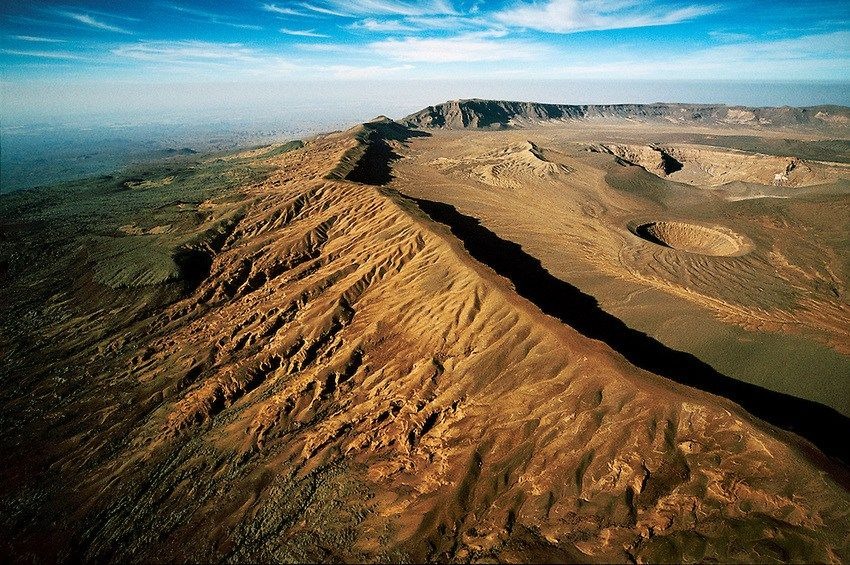
Tibesti comprises a series of volcanic mountains, though their activity isn't always apparent due to the region's isolation. Among the highest peaks: Emi Koussi (3,445 m), Pic Toussidé (3,313 m), Tarso Voon (3,100 m), and Tarso Toon (2,625 m).
Emi Koussi, the Sahara's highest point, emerges as a supervolcano with a lunar landscape. Pic Toussidé stands out for the "Natron Crater," a crater plunging 1,000 m deep. At its base, a thick layer of natron salt sprawls like white snow, crunching underfoot as you walk.
Rivers originate in the Tibesti massif, though they rarely sustain themselves long. They either disappear underground within kilometers or evaporate in the extreme desert heat. Water flows vary dramatically due to unpredictable, irregular rainfall. The mountains also conceal temporary and permanent water sources, including hot springs and sequential pools.
Mountains of Hunger
Survival challenges both wildlife and humans in Tibesti, which receives minimal rainfall. Beyond a few hidden oases, survival is barely feasible. Yet rock paintings preserved in millennia-old caves prove conditions weren't always this way. Once, Tibesti appeared as green savanna, visited frequently by early peoples.
Local fauna and flora exhibit significant endemism levels. Inhabitants include the African wildcat, striped hyenas, reptiles, addax, barbary sheep, and rodents.
The local human population numbers under 10,000, predominantly Toubou. Like the Bardaï, Aozou, and Zouar groups, settlements cluster near oases in the wadis.
Climate
Tibesti enjoys a desert climate, notably more humid than the surrounding Sahara. Storms can bring heavy downpours, though rainfall remains unpredictable and irregular year to year. Average maximum temperatures range between 20°C and 30°C depending on altitude.
Zouar, situated 1,200 km north of N'Djamena at Chad's frontier, serves as the gateway for adventures in the Tibesti massif. It features an airstrip connected to the capital—only twenty-seat aircraft can land.
Explore Tibesti on foot or by pack animal. A few dirt tracks flanking the massif, passable only by four-wheel-drive vehicles, typically end at peak bases or crater approaches.
What to Do in the Tibesti Massif?
- Summit the Sahara's highest peak, Emi Koussi
- Explore the rim of the Natron Crater at Mont Toussidé
- Seek out hot springs
- Savor untouched panoramas
- Discover the massif's wild flora and fauna, and more
Want to discover this destination?
Our local advisors design your tailor-made trip.